|
|
|
 Name:
Mostar. This place includes the Slavic word "most", which means 'bridge'. Together with the
ending, the whole name means something like keeper of the bridge. This refers to the old bridge in centre of town
built in the 16th century, destroyed during the last war and recently rebuilt.
Location:
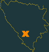
Mostar is around 100 km South of the capital →Sarajevo and only 50 km North
of the Adriatic coastline. The city marks the centre of the historical province Hercegovina (Herzegovina).
The small and clear Neretva river flows from South to North and separates the town
into Eastern and Western Mostar. Mostar is surrounded by more-or-less high mountains, among them the 1,967 m high
Mt. Botin. The area West of Mostar is mountainous, too. Most mountains are bleak.
Population: Appr. 130,000. Therefore Mostar is the 6th biggest town of the country.
This number includes the suburbs - only every second citizen lives in the town itself. In pre-war Mostar, Croats, Serbs and
Bosniaks were equally large communities. However, today there are virtually no Serbs at all living in the city.
Orientation:
Beware: All data from 2001! Mostar is rapidly changing, i.e.
some of the information given might be out-of-date!

| |
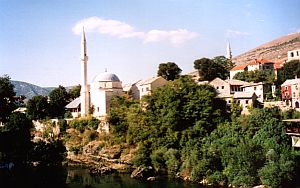
The old Muslim quarter
|
The small stretch of land between the Neretva and its tributary as well as a small stretch of land along the right
bank is part of the Muslim quarter. The rest is Croatian area. The border between the two parts is clearly defined
but not visible. At least it is not supposed to be visible - if the area would not have been the
frontline. The former frontline runs along ul. Aleske Šantiać (ul. = rd.) and
Blvd. Hrvatskih Branitelja. All buildings along the frontline were reduced to rubble during the war. The Western, Croatian
quarter is much more modern. On a big hill in the Southwest, a giant cross had been erected overlooking the whole
town. Additionally, a new church with a high tower, probably higher than the minarets in the Muslim quarter, had been built
History:
Mostar was probably founded around the 15th century and developed into a thriving
regional centre within the Ottoman empire. However, due to its location Mostar never managed to gain supraregional importance.

| |
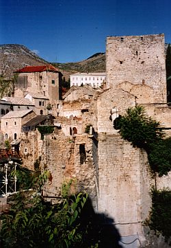
The destroyed historical bridge
|
Centuries later: After Bosnia-Hercegovina had declared independence in 1992, the JNA (Yugoslavian National Army) seized
most of the territory of Bosnia. Fights broke out in the area of Mostar as well. Croats and Bosniaks united and
managed to drive out the Serbs including the civilians. But Croats had had other plans. Shortly after the victory,
Croats founded the Republik Herceg-Bosna around Mostar and eventually demanded the
unification with →Croatia. Mostar was supposed to be the capital of
the new republic. And so heavy combats between the former partners errupted. Especially the Muslim quarters suffered
massive and permanent shellings. Sadly, this situation culminated in the destruction of Stari Most (Old Bridge),
which had been filmed. These images became the symbol of Mostar's tragical history.
Under pressure from outside, both parties agreed on a cease-fire. This didn't mean that the citizens started to live in peace and
harmony again, but at least combat actions were stopped. Eversince Mostar is divided into a Bosniak and Croatian part.
Everyone can feel free to cross the border, but only a few do. The war has left ugly scars all over the place. There was a ray of hope
when the Old Bridge was re-opened in July 2004. Thanks to generous private donations, the bridge could be restored and
the re-opening caused quite a hoo-ha. Of course it was a controversial decision - many people argued that the bridge shouldn't be
restored to leave the pile of rubble as a warning for generations to come. Maybe it helps to get back to normal life. However,
the ongoing contest à la "Who's building the most magnificent House of God" leaves the visitor with doubt.
Getting there:
The train station is a bit out of the way, and there's only route connecting →Sarajevo
with Ploče, a small town at the Adriatic coast. I'm not sure whether the route is still active or already discontinued.
It's better to stick to buses - there are daily buses to →Dubrovnik,
→Split and →Sarajevo. The latter needs two hours, the fare is
KM 11.
|